Xiaomeisha launches nation's 1st smart coastal monitoring platform
Writer: Lian Jiaqi | Editor: Lin Qiuying | From: EyeShenzhen | Updated: 2025-08-26
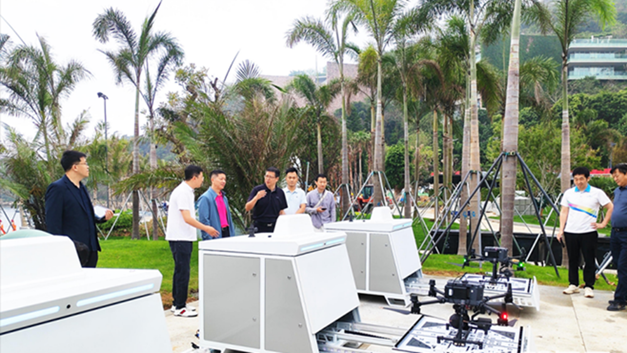
The Xiaomeisha Low-Altitude Coastal Smart Monitoring Platform has recently begun trial operations, marking China’s first intelligent low-altitude monitoring system specifically designed for coastal environments.
Drones are on standby for the Xiaomeisha Low-Altitude Coastal Smart Monitoring Platform at Xiaomeisha, Yantian District. File photos
This groundbreaking platform has combined three core technological innovations — autonomous low-altitude patrol, multispectral polarization imaging, and AI-driven multimodal recognition — to establish a comprehensive, smart drowning-prevention system that integrates maritime surveillance, land-based response, and aerial patrol.
Earlier this year, Xiaomeisha partnered with China Unicom Shenzhen, Xi’an Jiaotong University, and others to develop these advanced technologies and construct a low-altitude, three-dimensional emergency rescue system.
The deployment of “autonomous low-altitude patrol + multispectral polarization imaging” penetration monitoring in a coastal bathing area represents a pioneering achievement in China.
The system employs polarization light separation algorithms to eliminate surface glare, shadows, and various types of interference, enabling polarization cameras to accurately detect human postures in the water — even under challenging lighting conditions such as strong backlighting or overcast skies.
With three drones operating in rotation, the platform delivers precise, grid-based, full-coverage, real-time monitoring without any blind spot. Each drone covers roughly 134 hectares — equivalent to 188 standard football fields — and can complete a full patrol of the bathing area within 15 minutes. This advanced system significantly enhances safety measures for beachgoers and residents alike.