City issues white typhoon alert ahead of Friday landfall
Writer: Li Jing | Editor: Yu Xiyao | From: Shenzhen Daily | Updated: 2025-09-19
Shenzhen is bracing for worsening weather this weekend after the local meteorological observatory issued a white typhoon warning at 11 a.m. yesterday and upgraded the alert for the Shenshan Special Cooperation Zone from white to blue at the same time.
Typhoon Mitag, the 17th storm of this year, was about 520 kilometers from Shenzhen at 11 a.m. yesterday, the observatory said. It is forecast to make landfall along the coast between Huilai and Taishan in Guangdong Province — most likely in the Shenzhen–Shanwei area — sometime between midday and midnight tomorrow. Strong winds and heavy rain are expected across Shenzhen, with higher risk concentrated in the Shenshan Special Cooperation Zone.
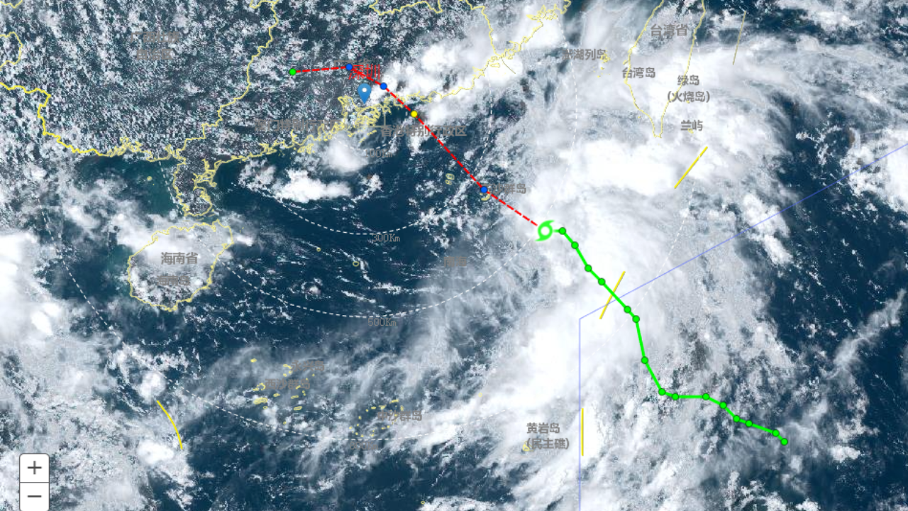
A satellite image shows Typhoon Mitag approaching the Guangdong coast as of 11 a.m. yesterday. Photos courtesy of the Shenzhen Meteorological Bureau
Because the typhoon is still moving, authorities cautioned that warning levels may be adjusted. Shenzhen will see showers over the weekend, with unstable conditions and the possibility of short-duration heavy downpours on Friday and Saturday that are expected to weaken by Sunday. Temperatures are expected to fall slightly, ranging from 24-30°C.
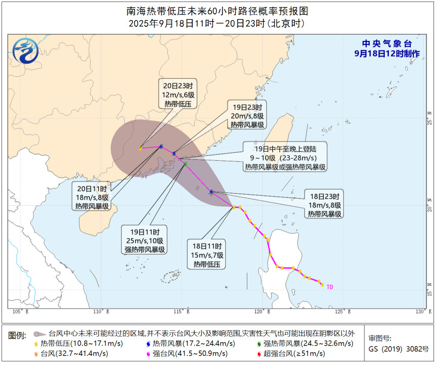
A 60-hour projected path of Typhoon Mitag from 11 a.m. yesterday to 11 p.m. Sept. 20.
Two other tropical systems are also developing over the South China Sea and the western North Pacific. One, currently east of the Philippines, is forecast to intensify into Typhoon Ragasa (No. 18). Forecasters say Ragasa could reach at least severe-typhoon strength and has the potential to become this year’s first super typhoon. It is highly likely to affect South China. A separate disturbance that could become Typhoon No. 19 remains far out at sea and is expected to curve away, posing no threat to China.
Meteorologists note that late summer and autumn are China’s most active typhoon seasons, with autumn storms often being stronger. By August and September, the ocean has stored maximum heat energy, creating ideal conditions for tropical systems to develop. At the same time, the intrusion of cold air from late August to early September can increase the pressure gradient and wind speeds near a typhoon’s center, aiding intensification.
The weakening of the South China Sea summer monsoon during this period also tends to make autumn typhoons more symmetrical in structure, allowing them to grow more powerful.